
Plan extraordinary drives across Europe's greatest roads.
Curated routes, multi-day itineraries, and a trip planner built for enthusiasts. From the Stelvio to the Furka — every great road in one place.
Trips worth taking
Hand-built routes across Europe's best driving regions.
Europe's most extraordinary drives
The roads every enthusiast needs to drive at least once.

Built for drivers, not tourists.
Curated, not crawled
Every road on Swissotic has been driven and rated. No autogenerated lists, no tour-bus routes, no filler.
Plan day by day
Build trips from real roads. Add hotels, photo stops, drive times. Export to your nav and calendar.
Live conditions
We track pass openings and closures from official sources daily. Plan with confidence.
Discover. Plan. Drive.
Discover
Browse curated roads filtered by type, country, and what your car can handle.
Plan
Build your trip day by day. Add roads, hotels, and photo spots.
Drive
Export to GPX for your nav, iCal for your calendar. Hit the road.
From the guides
Practical writing from drivers who actually use these roads.
Want us at the wheel?
Small-group guided driving trips through the Alps with a host who actually knows these roads. Coming this summer — join the waitlist.
Europe's greatest driving roads — planned properly
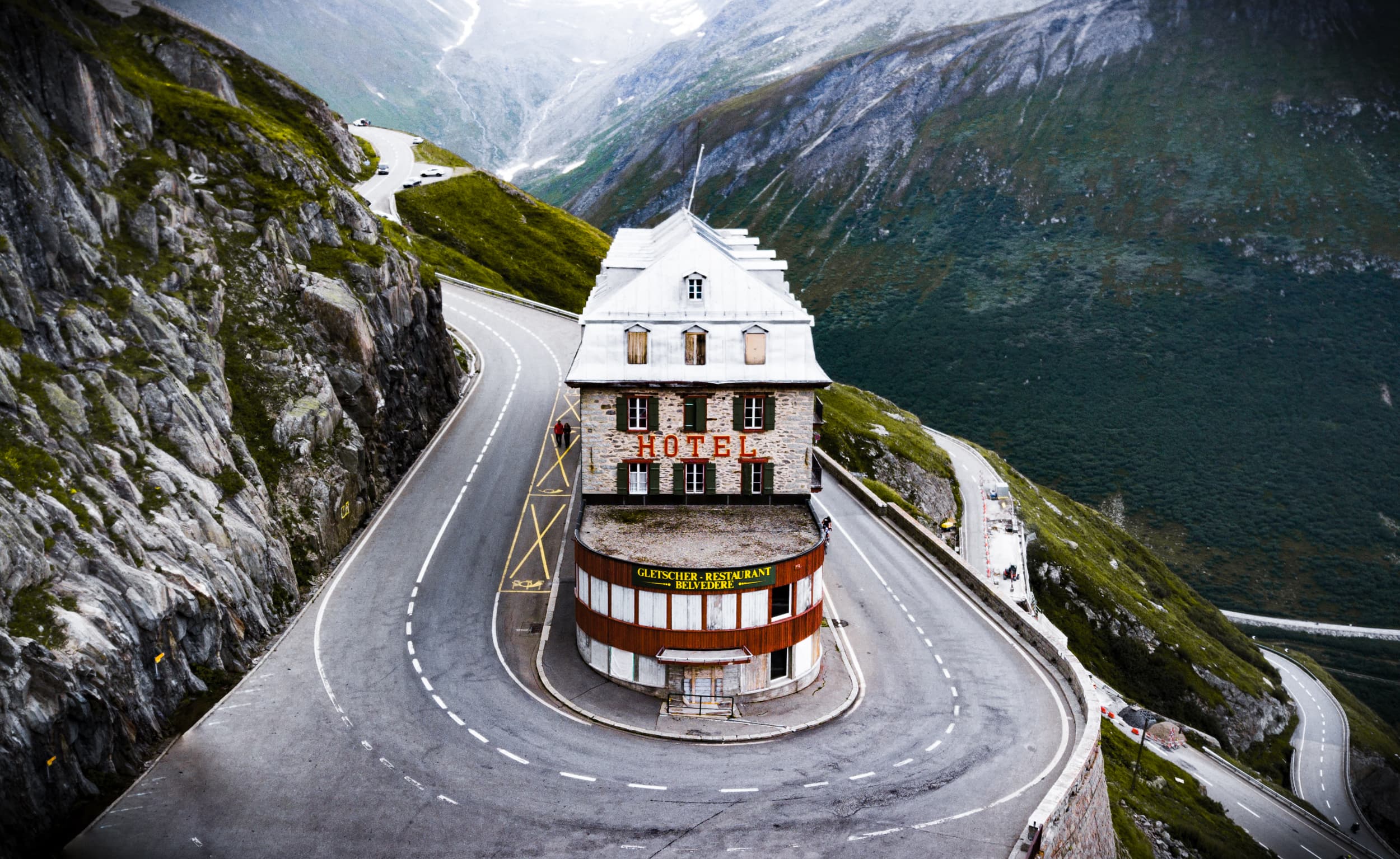
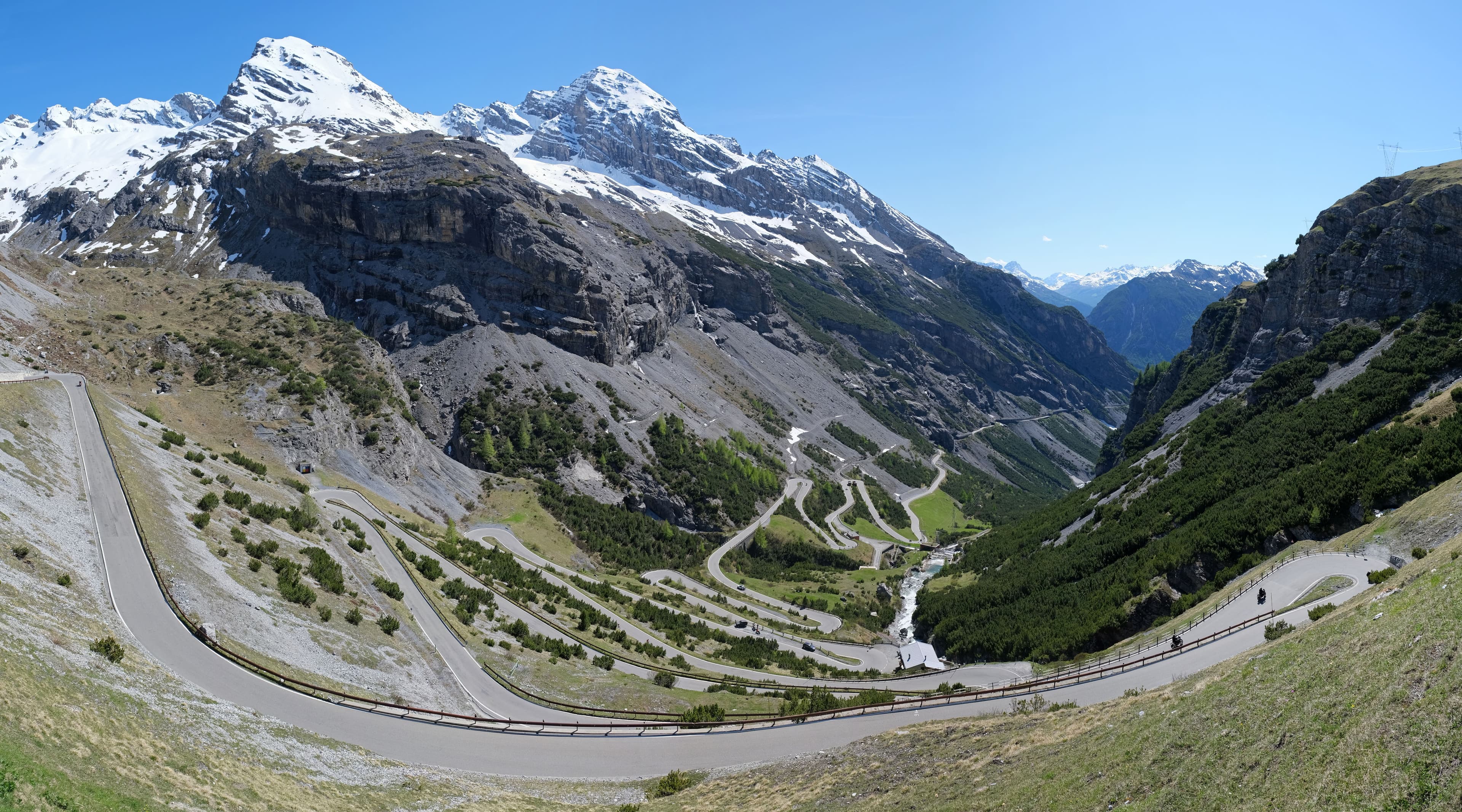
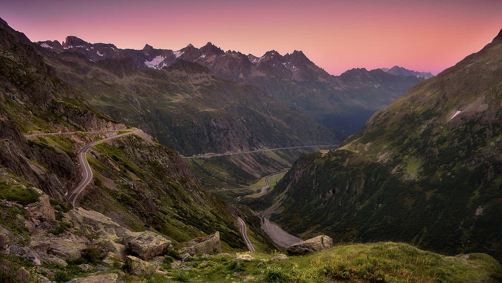
Europe is a 6,000-kilometre playground for anyone who loves to drive. The Stelvio Pass and its 48 hairpins. The Furka Pass and its James Bond curves. Austria's Grossglockner High Alpine Road. The Dolomites' Great Road. France's Route des Grandes Alpes. Switzerland's Big Three — Furka, Grimsel, Susten — driveable in a single weekend if you know what you're doing.
Swissotic is the planning platform built for enthusiasts taking a driving holiday in Europe. We've curated every road worth driving across Switzerland, Austria, Italy, Germany and France — with proper editorial guides, photo spots, and live pass conditions tracked from official sources. The trip planner lets you build day-by-day itineraries with hotel stops and one-tap GPX export to your nav.
Whether you're flying into Zurich for a week of swiss alps driving, planning a dolomites road trip with a rented Porsche, or finally checking the Grossglockner off your bucket list — Swissotic gives you the roads, the routes, and the data. No tour buses. No package deals. No dumbing down.
Start planning your next great drive.
Free to use. Premium unlocks unlimited trips, GPX export, and photo spots.